End of a Project - Beginning of a Journey

(Phase 3 – Final Phase)

We are pleased to announce that the project work has officially ended on the heath with a final planting on the various islands and along Sussex Road.  We appreciate that there is still much work to complete, and much of this will now be down to nature taking its course.  Project Manager Steve Field signed off the project with our contractors Five Rivers, and handed the pond back to Doug Budd, our Grounds Manager.

Doug Budd and his team are now maintaining the areas that have been planted, slowly replacing the ‘not so welcome’ green netting for a softer rope and pole option, as well as planning the next round of planting which will take place sometime in the Autumn.

New signs have been ordered for Duck Island and once these are in place, Duck Island will be open to the public.

Our fishing community, headed up by Dave Chambers, has kindly offered to keep an eye on the Islands, keeping the netting in place so that further floral can be encouraged to grow, and begin to soften the current view of the black material (Nicospan).

The new boardwalk has been the centre of attention this year, as many of the birds that have nested, has used this area as a crèche for their offspring.

Petersfield Town Council are delighted to have received retrospective planning permission for all the works on the Heath. Phase 3 of the works will start again in mid-late April when border areas and islands will be planted with reeds and other plants to complete the long-awaited transformation of the Heath Pond.

Phase 2 of the pond works has now been completed, and the following diagrams illustrate the works that have been carried out. This includes the boardwalk, islands, bridge to duck island, cladding along the Plump Duck and Playground areas and the re-establishment of the banks.

General Arrangement
Technical Details - Recycled Plastic Cladding
Technical Details - Boardwalk
Technical Details - Bank Stabilisation Works
Technical Details - Islands & Reedbeds

Work has now been completed on the heath lake in terms of the movement of silt within the pond basin, and the pictures above illustrate the changes from how the lake was before work commenced, and how the lake is looking in terms of depths now that the work has been completed.

Technical Details - Gravel Launch
Technical Details - Kit Structures
Before
After

Pond Stabilisation Phase 2 – from 3rd August for 5 weeks from 3rd August, the Five Rivers contractor will be returning to continue the work on the Pond Bank Stabilisation.  The work will take approximately 5 weeks to complete, and will consist of the following elements:

  • Implement solutions to the Nicospan material so that strands of thread are not able to come away and affect the wildlife.
  • Carry final snagging works on the board walk.
  • Introduce coir and coir matting along Sussex Road area to introduce water level plants and provide additional support to the banks.
  • Re-plant areas where plants have not survived with alternative species or different plants, and implement a watering schedule depending on weather conditions.
  • Hydro seed new recovered areas of bank with low level plants.
  • Hydro seed new Islands with low level plants.
  • Introduce fascia boards along the north face of the pond.
  • Level any sand humps that have been created by the dredging, in particular those near to the edge.
  • Introduce FlexMSE bags mainly on the east side of the heath where there are current hard edges to introduce further planting.
Presentation by Five Rivers Environmenal Contracting

This project aims to increase biodiversity in and around the pond and restore areas where the banks have been eroded.


A pond in good health is an incredibly rich and varied habitat for wildlife. When the environmental conditions are right, an array of different plant species grow in abundance, creating a spectrum of aquatic zones in which a myriad of different creatures manage to find the right kinds of spaces to flourish. Unfortunately, the Heath Pond is poor in biodiversity and a mono-culture is developing.

The work of this project includes:

  • Renewal and restoration of eroded banks
  • Planting of over 1,000 suitable native bank-side plants
  • Three peninsula fishing swims
  • Coppicing of bank-side willow trees and other trees which excessively shade the pond
  • Creation of new two islands, using dredged material and planted with native marginal species
  • Pond bed reprofiled in certain areas to create a mosaic of marginal habitat
  • Planting in three locations of Phragmites australis to create additional reed-beds
  • Replacement boardwalk which is wider, with handrails and passing place

The requirements for the work was first identified in the early 2000s, however planning did not begin in earnest until 2015. Once areas or work had been identified with key stakeholders high level proposals were prepared.

A Public Consultation was held, including boards displayed around the Heath. A range of views and an overall positive feedback was received in response to these proposals.


In 2019 Petersfield Town Council held a tendering exercise and received 8 bids to design and deliver the project.  Four bids were shortlisted an each made a presentation to members of the Grounds Committee and Officers of Council.


On the 19th September 2019 Petersfield Town Council awarded the contract for the project to Five Rivers Environmental Contracting Ltd.

It is hoped that the work will commence in the Autumn of this year, with planting work happing during late Spring 2020.


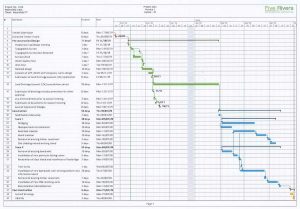
Five Rivers Timeline

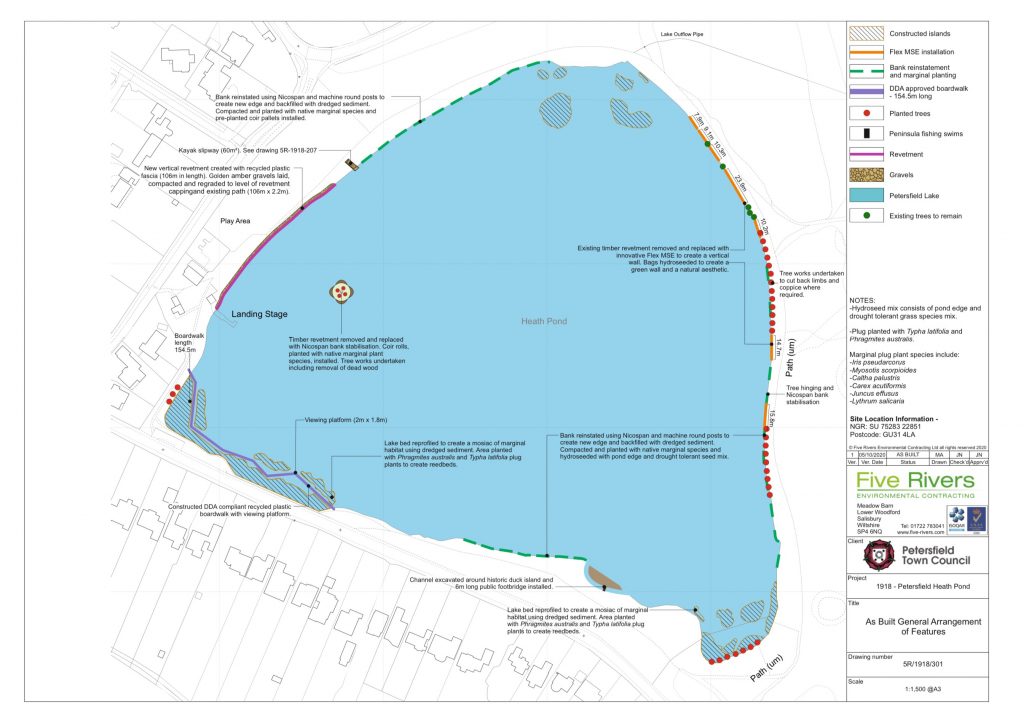
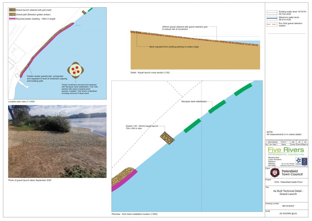
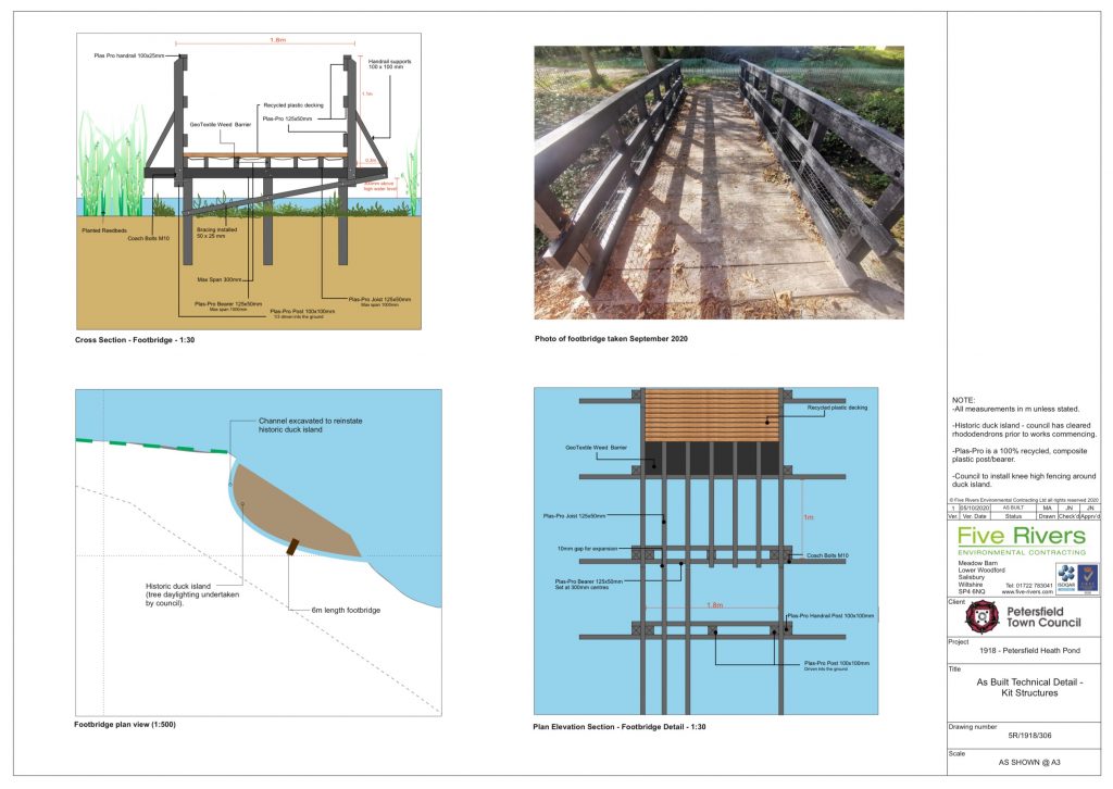
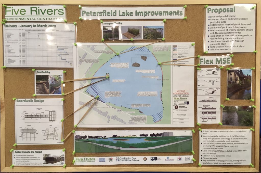
Work is due to commence on site in late January 2020 and expected to take 12 weeks to complete.  During this time some areas on the edge of the pond will be closed to public access.  It is not anticipated the actual path around the pond will be closed except for short periods when machinery is being moved around.

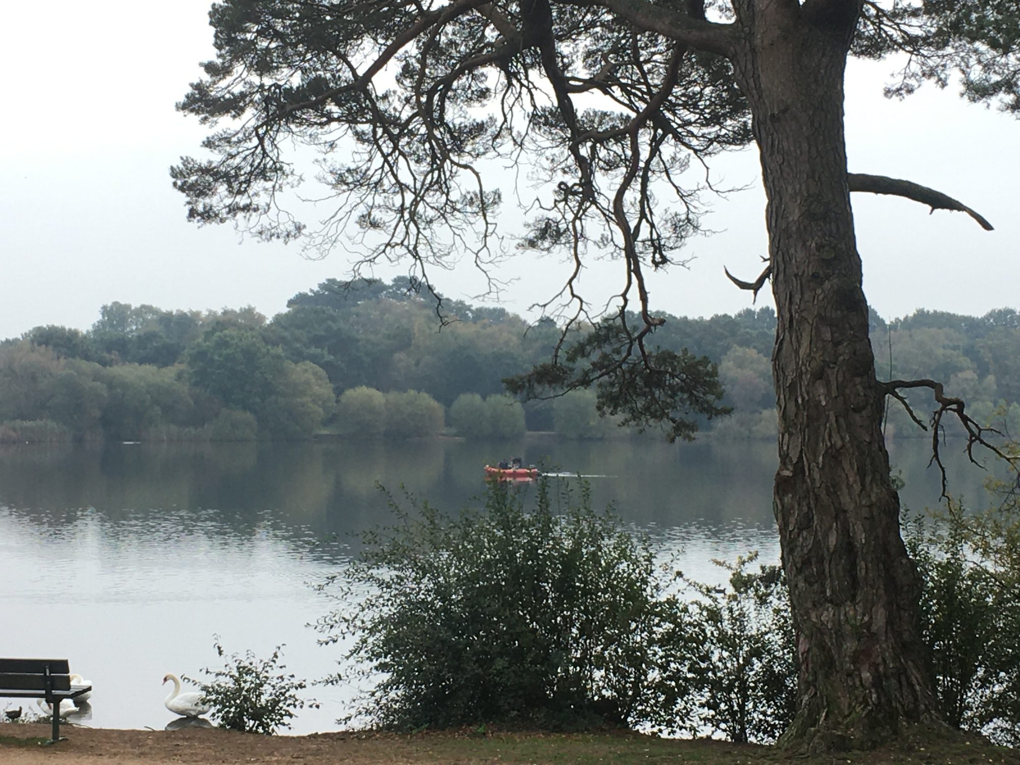
17/10/2019 – Topographic Survey Completed
Topography is the study of the shape and features of land surfaces

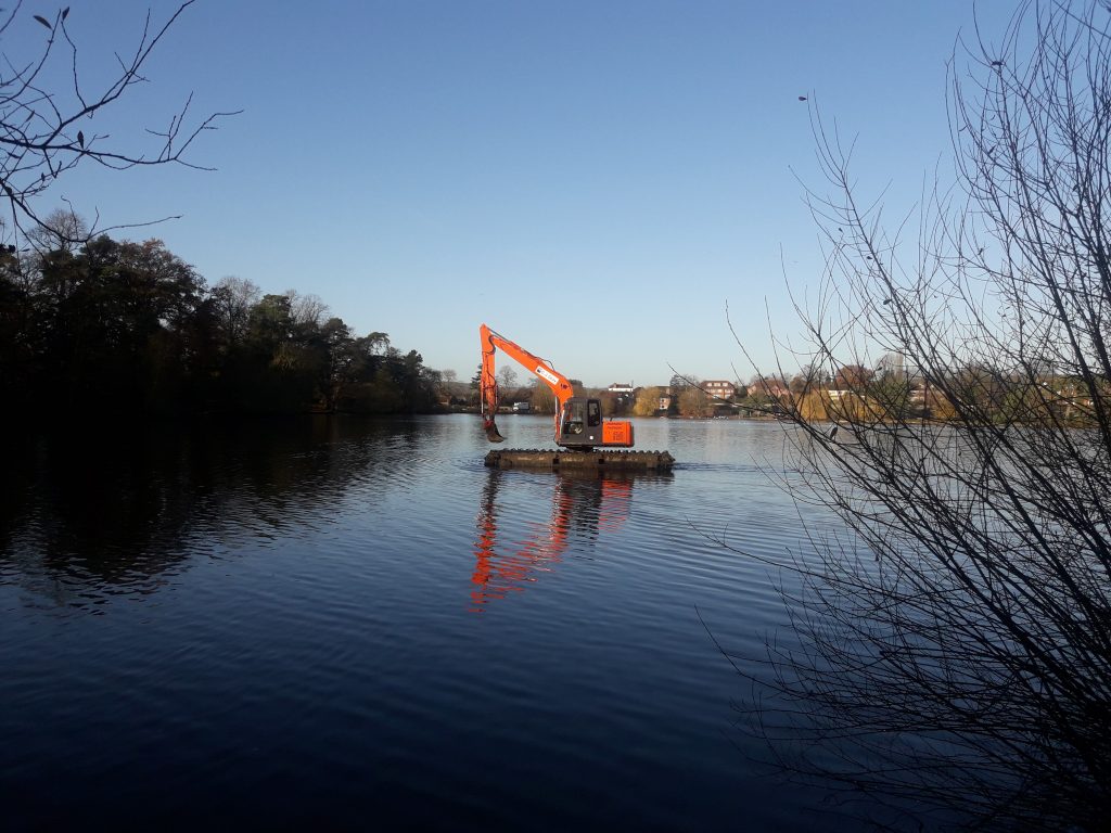
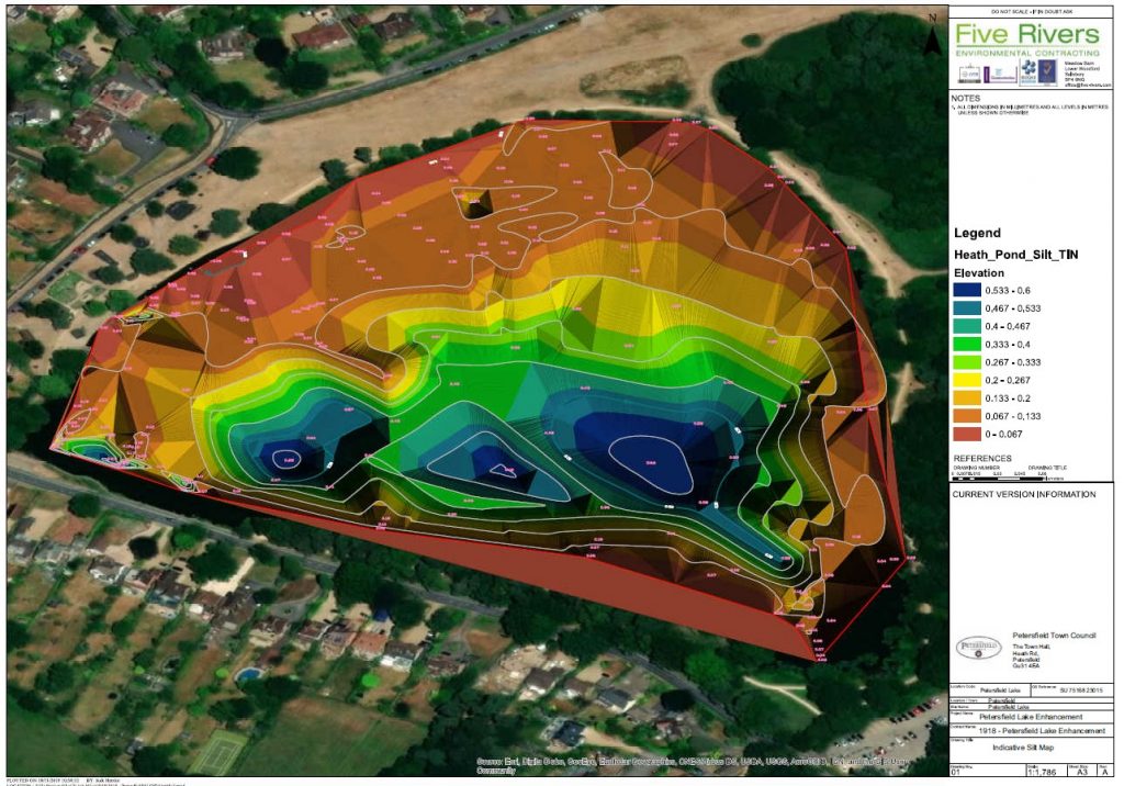
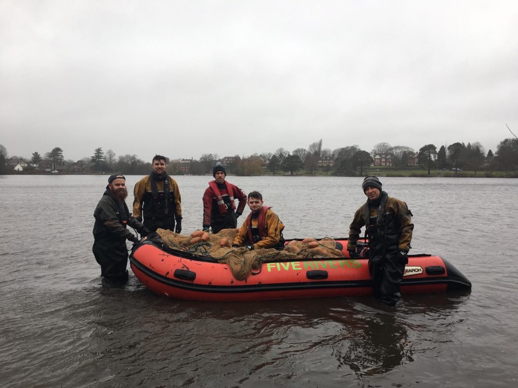
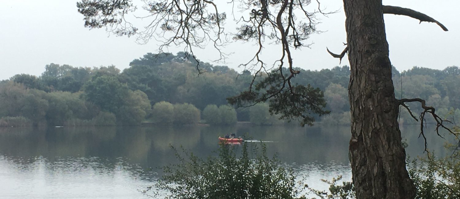
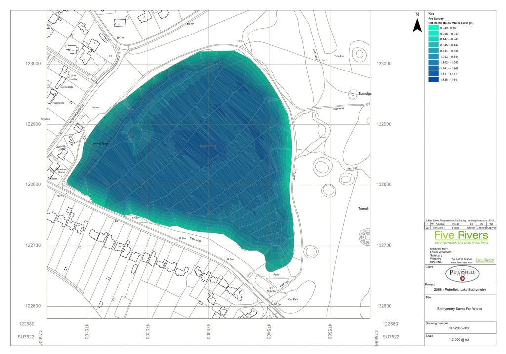
22/10/2019 – Bathymetric Survey Commences
Bathymetry is the study of underwater depth of lake or ocean floors. In other words, bathymetry is the underwater equivalent to hypsometry or topography.

29/11/2019 – Amphibious Excavation

An amphibious excavator is a type of excavator that can perform dredging while afloat in shallow water.  This work has allowed the team to understand more about the make up of the silt at the bottom of the pond.

Amphibious Excavator
Indicative Silt Map

12/12/2019 – Fish Survey

A 2 day survey took place. This involved using a combination of seine netting and electric fishing.

The seine netting of 100 x 4 metre was deployed from a boat and used for sampling in the deeper areas of the pond. Electric fishing was used in the shallower areas and around the island. The data collected allows for an understanding of species assemblage and stocking density.

Comments are closed.

Close Search Window
Skip to content